|
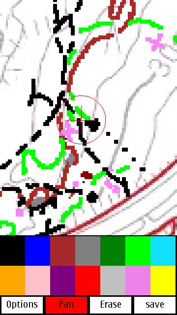
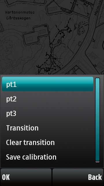
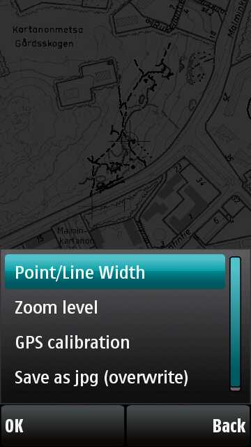
Orienteering mapping app for Nokia s60 5th edition touch screen phones. - install pymapper.sis and Python 2.0 from https://garage.maemo.org/frs/?group_id=854 - make folder e:\pymapper to your phone (e: drive is memory card) - export base map as jpg from Ocad. save is as e:\pymapper\mappingmap.jpg - don't use too big base map images. With phones without much memory you may not be able to use it or save your work (out of memory). Slightly over 1000x1000 pixel images are usually fine. Instead, make several base map images and map them one by one by renaming mappingmap.jpg actual one as before starting the app. - open app, calibrate map with 3 points, opposite sides of the area. - if you used same dpi for all your base map pieces, the same 3 point calibration should work for all of them. You just need to use "gps calibration -> transition" tool to point your location. - use a good, accurate bluetooth gps. Carry it on your head/cap to get the best possible view to the sky. Make sure "BT gps" positioning method is enabled from phone's settings. - draw map with sharp stylus. - use "save" button to save backup versions often enough. These backups are saved at pyapper folder as "[time&date].jpg" - use menu's "save as mappingmap.jpg" when you finish your day's work. Note, it overwrites mappingmap.jpg. - use "mappingmap.jpg" images as backround image in Ocad and do the actual vector drawing there. Pymapper is just a raster sketching tool. - source is included, feel free to tweak it. This app is based on Pys60 Scribble (comes with pys60 2.0). Happy mapping! Screenshots:


Work in process - animation is based on backup images saved during mapping |